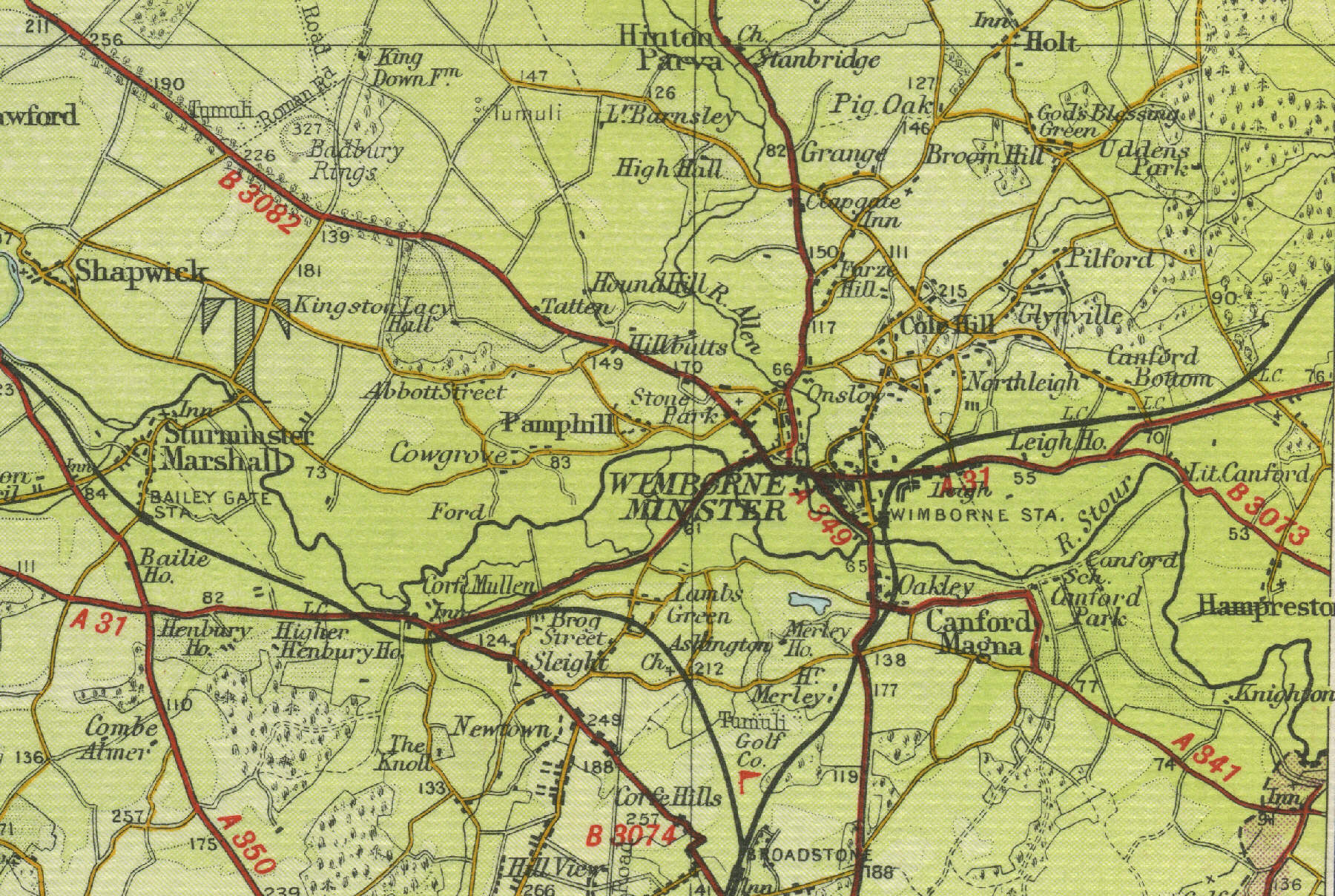
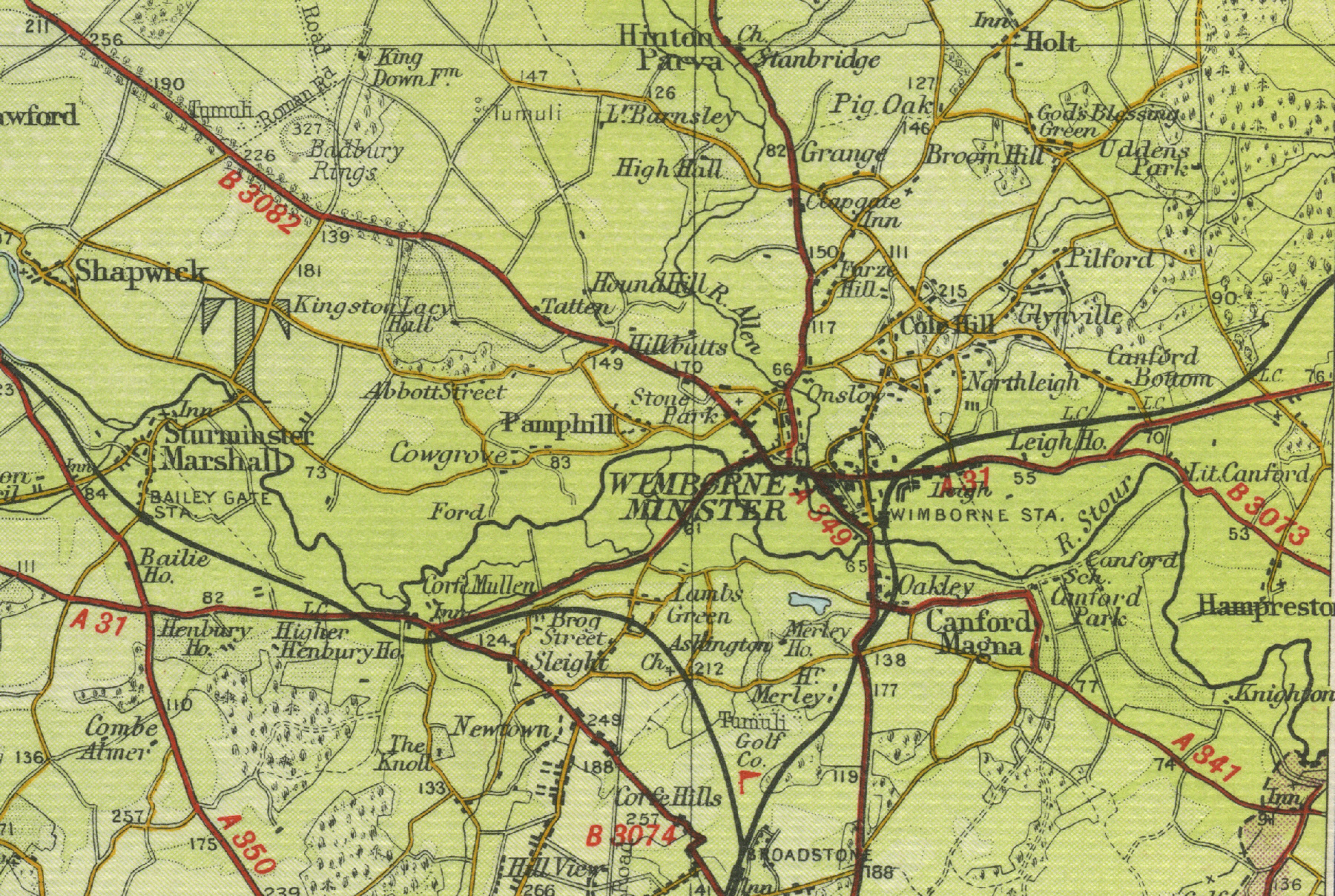
Wimborne Minster
Wimborne, lying in the shadow of its famous twin towered Minster church of Cuthberga, is an excellent touring centre for the surrounding Dorset countryside. Situated near the point where the River Wim, now called the Allen, joins the Stour, Wimborne, with its population of around 6000, serves primarily as a market town.
The map below shows
the features of the town of Wimborne Minster as it was in the mid
twentieth century. Click on a selected area of the map below to see an
enlargement.
|