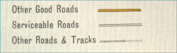
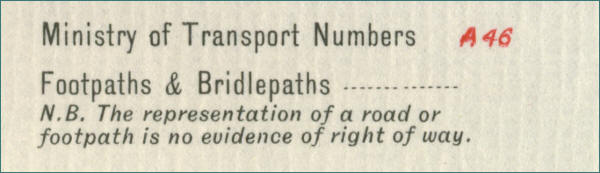
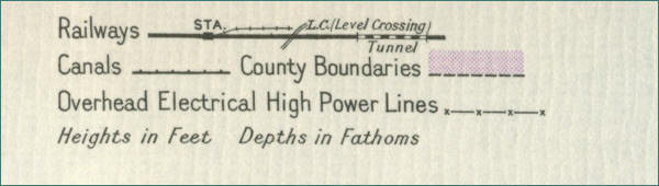
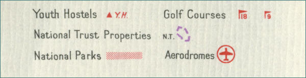
Map Key Bartholomew's Half-Inch Maps "The good companion for the wise traveller" Bartholomew's revised "half-inch" contoured maps were published throughout the greater part of the twentieth century at the Edinburgh Geographical Institute by John Bartholomew & Son Ltd. The map key below shows the meaning of the major symbols, for features such as roads, railway lines, canals, golf courses, National Trust properties etc., used on the half inch map series, extracts of which are reproduced on this website by kind permission of Collins Bartholomew. Key 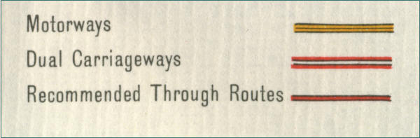 |