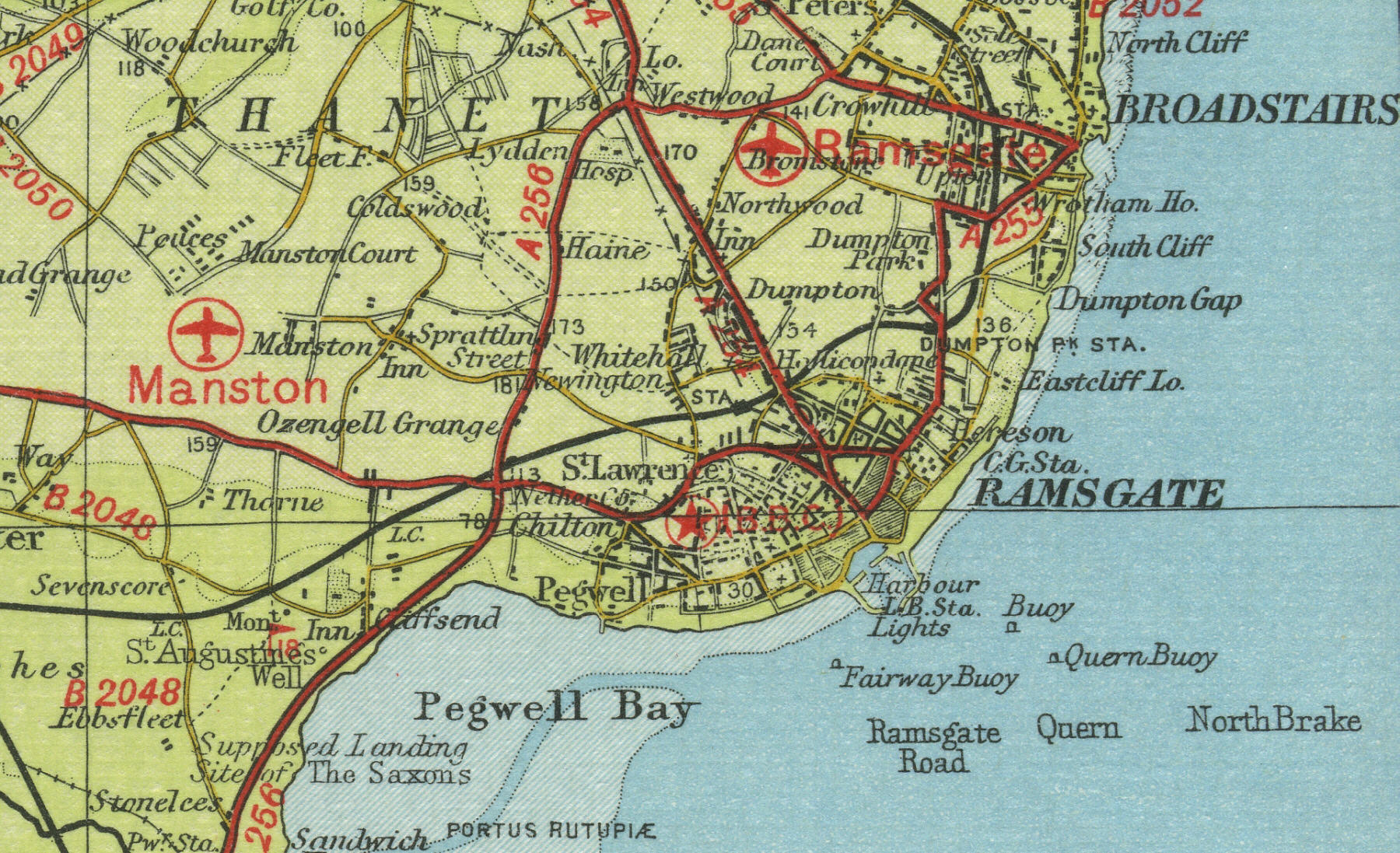
Old Maps  
     Map Index England Scotland Wales Interactive Maps Bookshop  
 
  Home
  England
  Scotland
  Wales
  Google Town Maps
  Bookshop
  Sitemap


Ramsgate

Ramsgate lies four miles south of Margate in Kent. With a resident population of over 40,000, Ramsgate, now a busy tourist resort, was a busy seafaring town from the eighteenth century. Today it is popular with yachtsmen and sea anglers. The hovercraft terminal one mile to the south has ensured Ramsgate’s continued importance as a cross channel port. The map below shows the features of the town of Ramsgate as it was in the mid twentieth century. Click on a selected area of the map below to see an enlargement.


 Ramsgate town map
 

Map of Ramsgate

Old map of the town of Ramsgate circa 1950

 
Click on a selected area of the map to enlarge
 

Map Key

The maps on this website have been reproduced with the permission of Collins Bartholomew


Home ] Map Index ] England ] Scotland ] Wales ] Google Town Maps ] Sitemap ] Links ] Privacy ]
 

copyright © 2007  www.oldemaps.co.uk