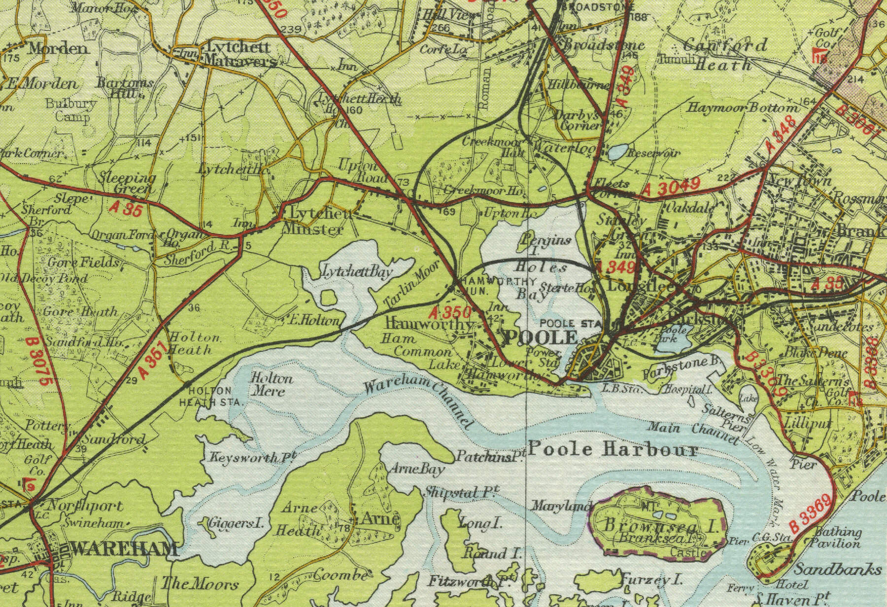
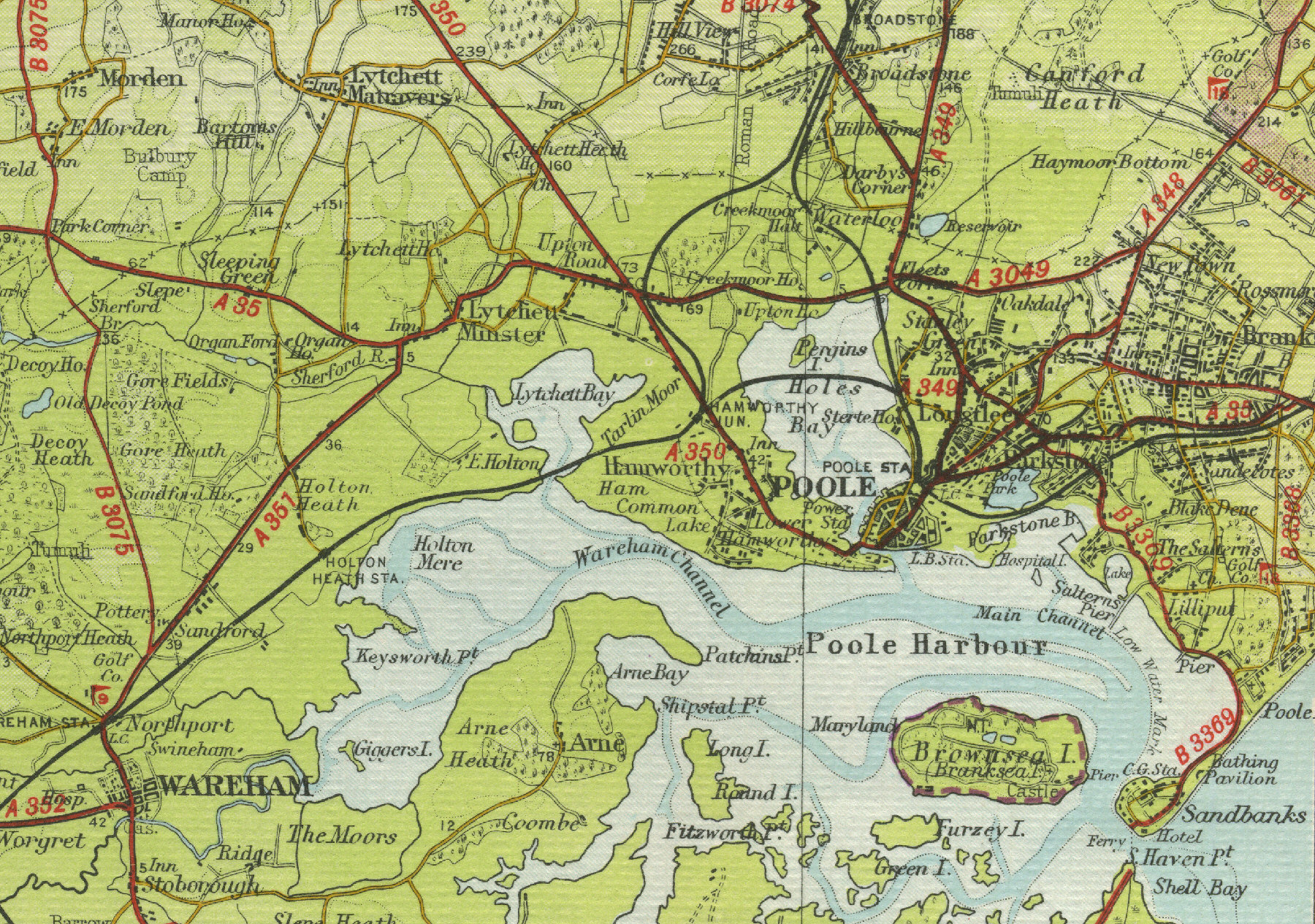
Poole
Poole, Dorset's largest town, lies
five miles to the west of Bournemouth. Poole's old harbour area is full
of historic interest, with many fine buildings, including the old
Guildhall, Scaplen's Court and Town Cellars, now museums, the Customs
House and the Lifeboat museum. The famous Poole Pottery is also worth a
visit. The port's development dates back to the thirteenth century but
today Poole's large natural harbour is used mainly by pleasure craft.
Poole is a major tourist resort, offering visitors fine sandy beaches
and has grown into a busy industrial and commercial centre with a
population of over 100,000. The map
below shows the town of Poole as it was in the mid twentieth century.
Click on a selected area of the map below to see an enlargement.
|