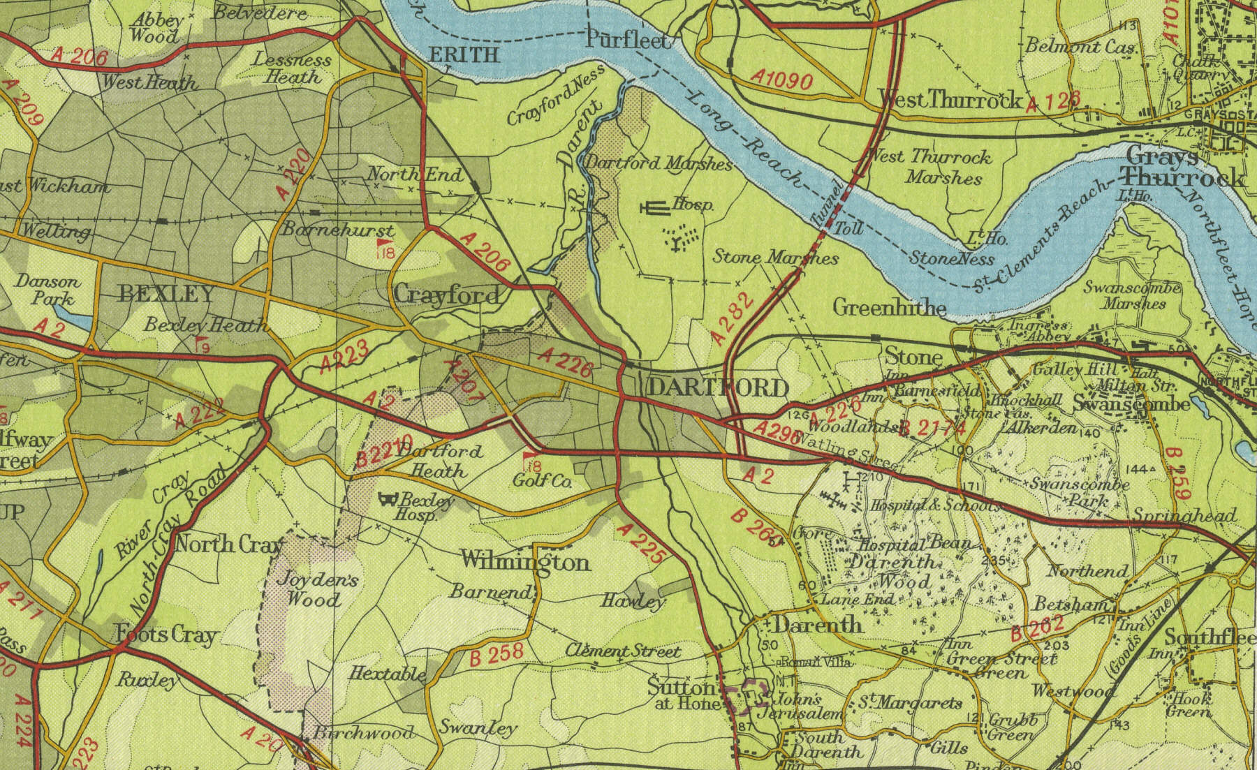
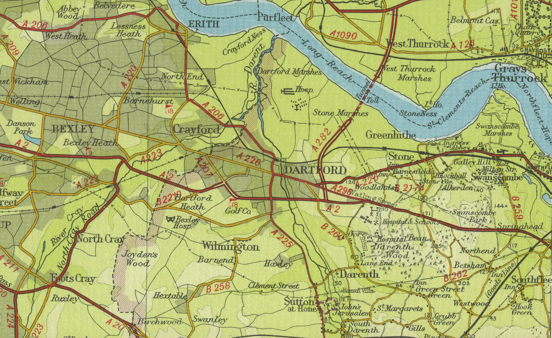
Dartford
Dartford, in Kent, situated twenty miles east of London with a population of around fifty thousand, has its origin, in pre Roman times, as a convenient fording point on the River Darent. Today Dartford's importance as a centre of communications has been emphasised by the completion in 1963 of the Dartford Tunnel, linking Kent and Essex via a one mile long tunnel under the Thames.
The map below shows the features of the town of Dartford as it was in
the mid twentieth century. Click on a selected area of the map below to
see an enlargement.
|