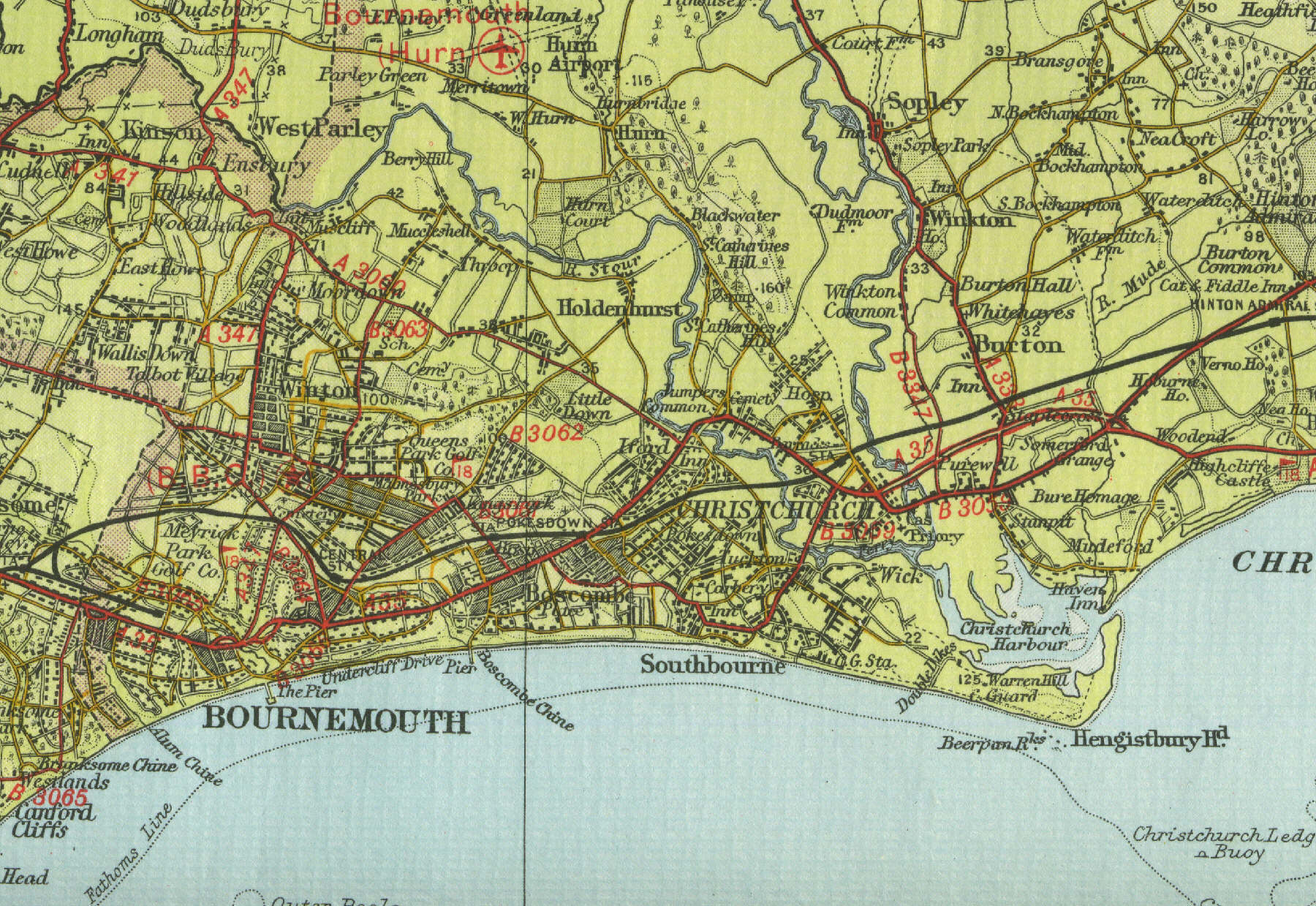
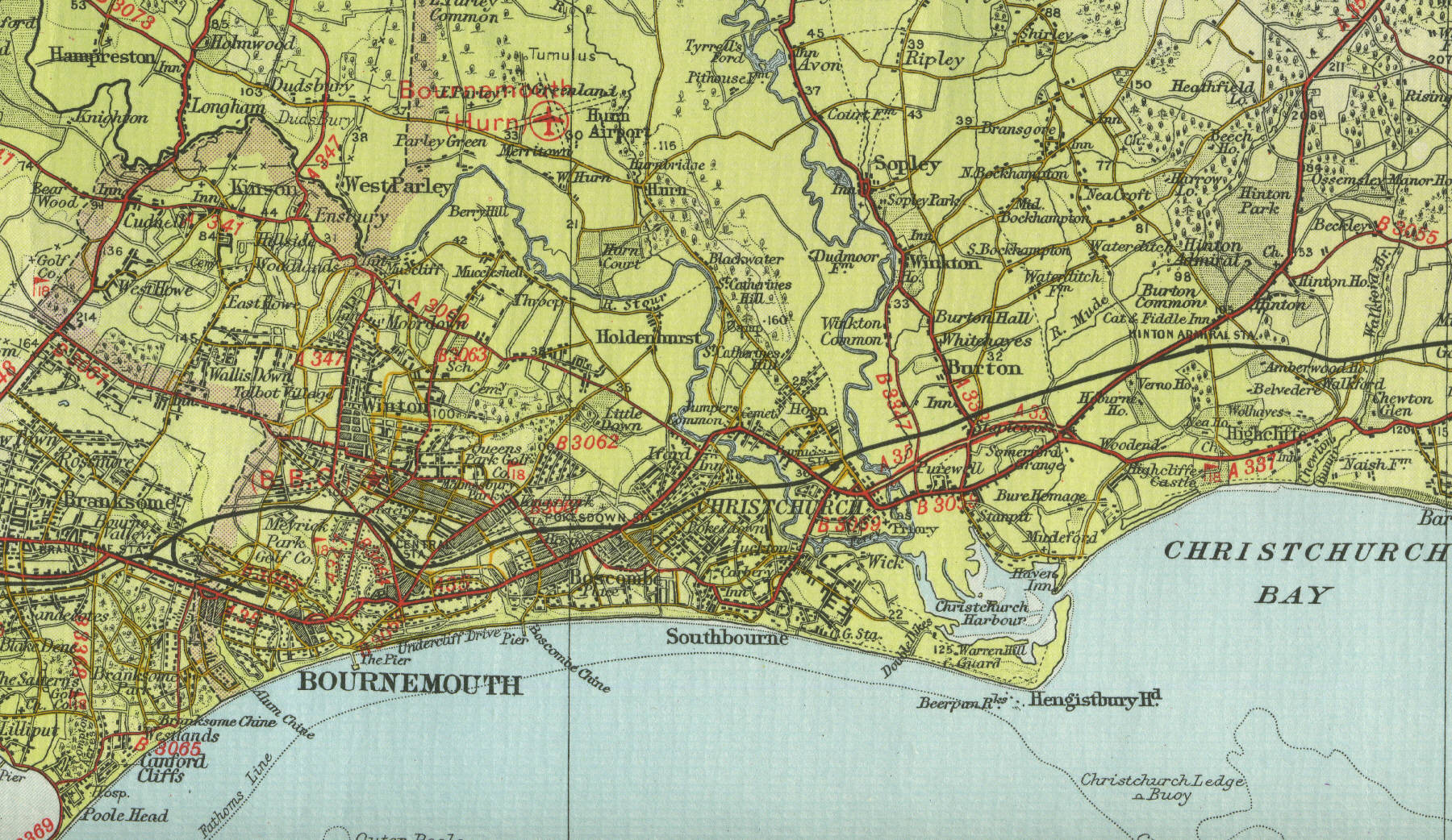
Christchurch
Christchurch, in Hampshire, lies at the meeting of the Rivers Avon and Stour. In Saxon times a walled town built as a defence against the Danes, Christchurch is now a popular holiday resort with a population in excess of thirty thousand. The town, once called Twynham, had its name changed on the building of the church in the twelfth century. Visitor attractions include the Red House Museum and Art Gallery, Stanpit Marshes, a nature reserve lying to the north of the harbour and Mudeford, an adjacent fishing village. The map below shows the features of
Christchurch, its streets and houses as they were in the mid twentieth century.
Click on a selected area of the map below to
see an enlargement.
|