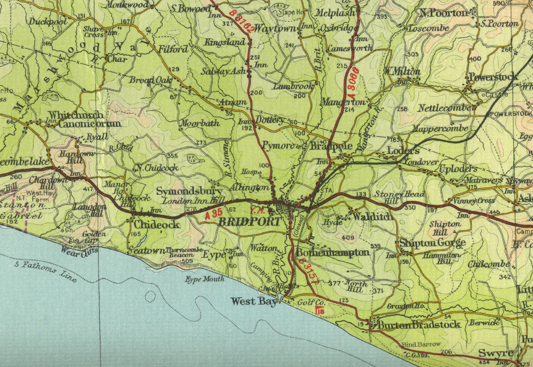
Old Maps

Map Index

English Towns

Scottish Towns

Welsh Towns

Bridport Map

Population 13,586
View an old map of the town of Bridport in Dorset as shown on the Bartholomew Half Inch map series of the mid twentieth century.
English Towns
Scottish Towns
Welsh Towns
Map Index
Old map of Bridport

Bridport

Bridport, Dorset, lies 15 miles west of Dorchester on the A35. With a population of over 13000, Bridport was an important rope making centre for use on sailing ships. The town,s wide pavements were ropewalks, used for twisting and drying the new ropes. The industry continues to make fishing nets and specialist ropes. The map shows the features of the town of Bridport as it was in the mid twentieth century.

Click on any area of the map to the left to see an enlargement.

          click map to enlarge


Old Maps Key - Roads

Old Maps Key - Roads and Tracks

Old Maps Key - Roads and Paths

Old Maps Key -  Rail and Canal

Old Maps Key - Parks

Old Maps Key - Height of Land in Feet

Sitemap

Privacy


The maps on this website have been reproduced with the permission of Collins Bartholomew

Old Town Maps