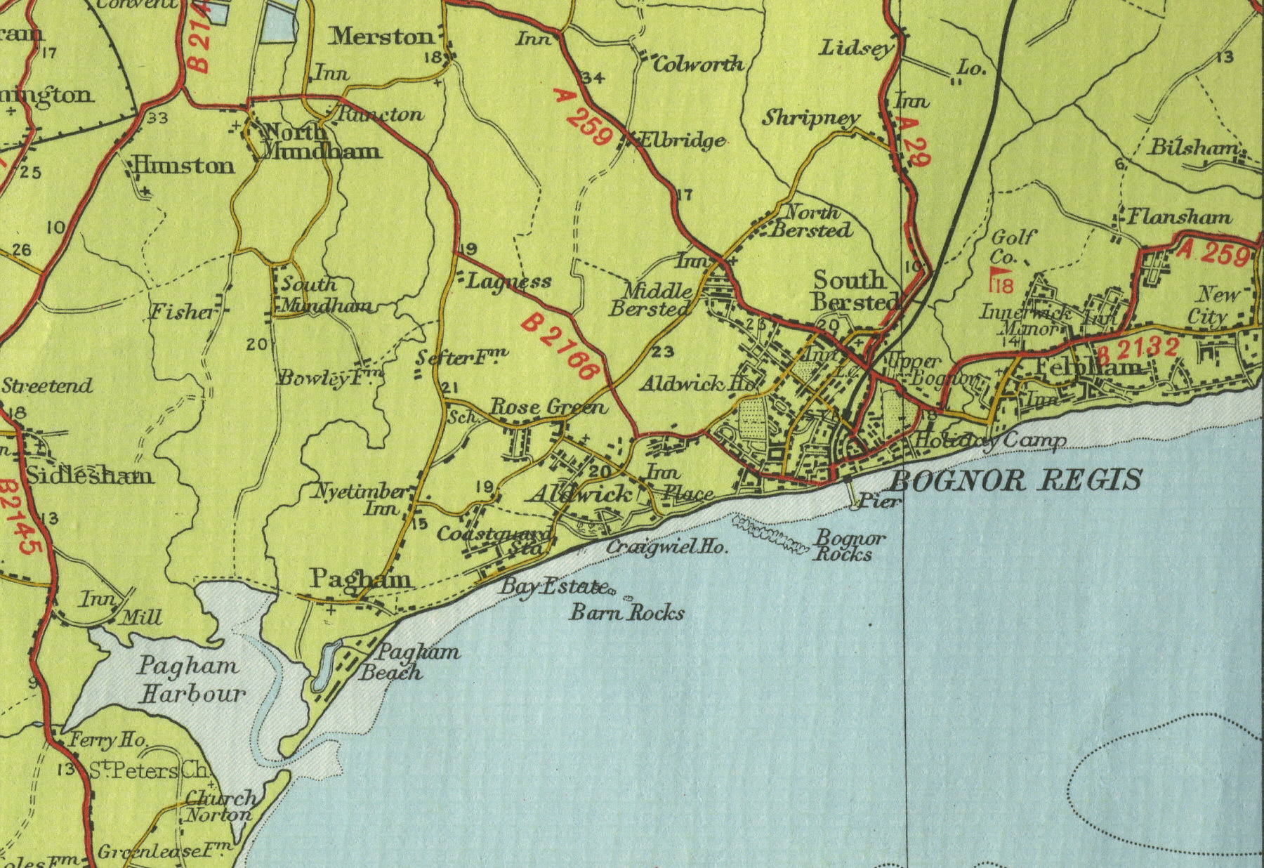
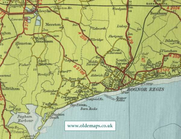
Bognor Regis
Situated seven miles to the south east of Chichester, with a resident population of around forty thousand, Bognor Regis originated as a fishing village in Saxon times. The seaside town became a favourite of royalty in pre Victorian times. Today’s visitors are attracted by five miles of beaches, pier and esplanade, good sea fishing and the amenities of Hotham Park.
The map below shows the features of the town of Bognor Regis as it was in
the mid twentieth century. Click on a selected area of the map below to
see an enlargement.
|