|
|
|
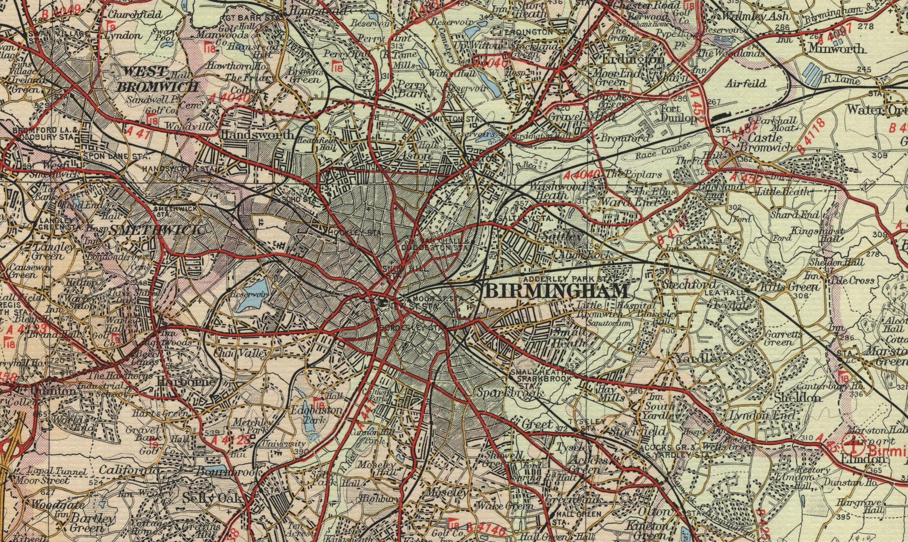
Birmingham
Birmingham is Britain's second
largest city, with a population in excess of one million. The city grew
out of the Industrial Revolution to become one of the world's greatest
industrial centres, specialising in metalwork of all kinds from
jewellery to steam engines. The early industries were served by a
complicated network of canals, now being redeveloped for leisure craft.
The centre of old Birmingham was the 12th Century market
known as the Bullring, now redeveloped as the heart of the city's
commercial centre, with the round office block the Rotunda symbolic of
the modern progressive city. The city boasts two cathedrals, the
Anglican St Philip's and the Roman Catholic St Chad. There are two
universities and a number of museums, including the Central Museum and
Art Gallery and the Museum of Science and Industry, which houses fine
collections from the city's industrial past. |