|
|
|
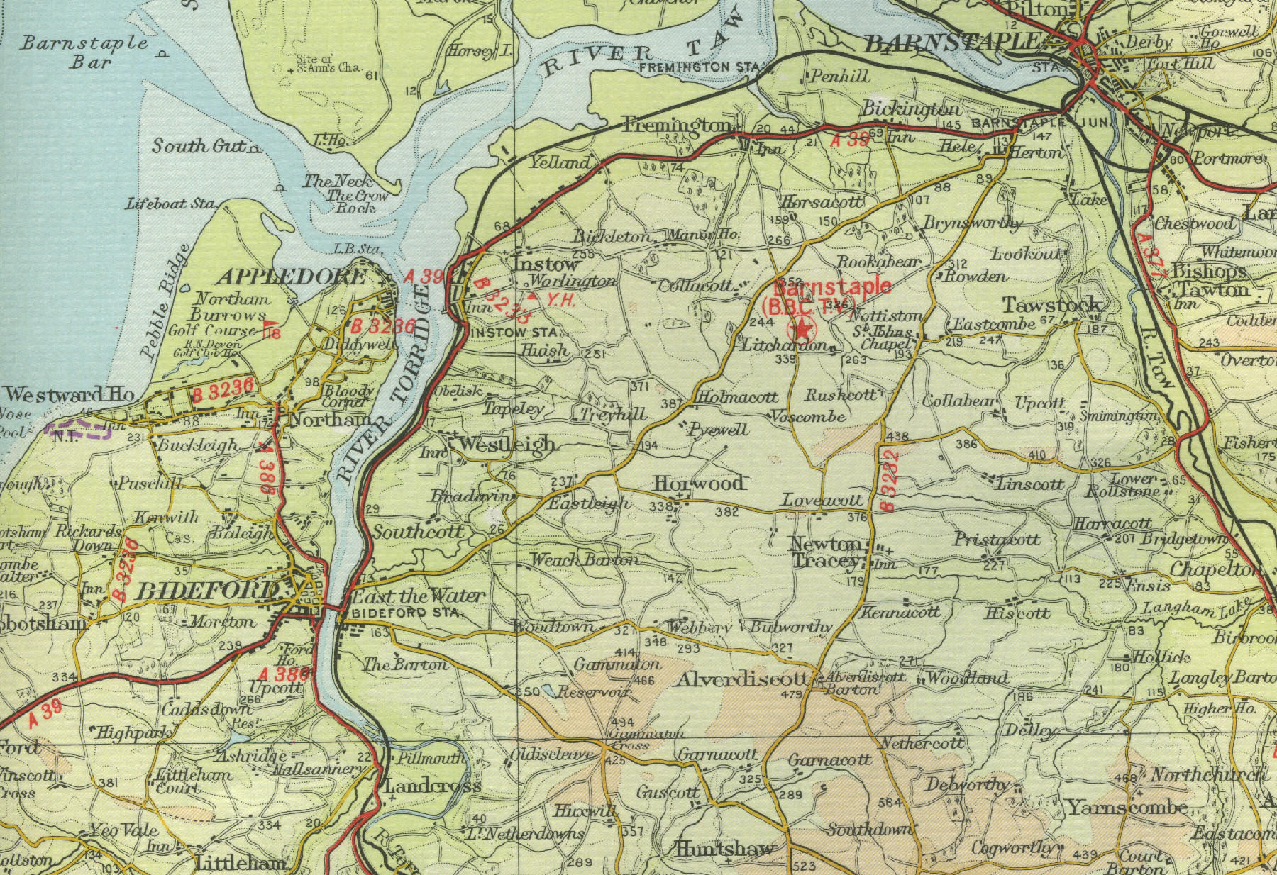
Bideford
Bideford is situated on the north
Devon coast just to the south west of Barnstaple and about forty miles
north west of Exeter. The town, with a population of around 20,000, sits
on the estuary of the River Torridge and was once, like its neighbour
Barnstaple, an important port and famous shipbuilding centre, with a
mile of quays along the banks of the Torridge. Although Bideford has
lost much of its importance as a port, small ships still use the port.
Bideford Bridge, built in the fifteenth century to span the river
Torridge, has 24 arches. Two miles to the north lies the seaside resort
of Westward Ho! taking its name from the famous Charles Kingsley novel.
It has a famous golf course and an excellent beach.
The map on the left shows the town of Bideford as it was in the mid
twentieth century. Click on any area of the map to see an
enlargement. |