Southampton
The city of Southampton is a major
port situated at the outflow of the famous chalkstreams Test and Itchen
in Hampshire. An important port in the thirteenth century, the Wool House, near Town Quay,
now a maritime museum, stands as evidence of Southampton's past prominence in
the wool trade. The ancient city walls bear many plaques relating
tales from the city's rich seafaring past. An important ocean liner port, Southampton has
often seen the great ships such as the QE2 and, more recently, the Queen Mary 2.
It was from here that the Titanic sailed on its final fateful voyage.
Today Southampton remains the major port in the south of England. In
addition, it is a university city and important commercial centre, with
a population of about 220,000. The
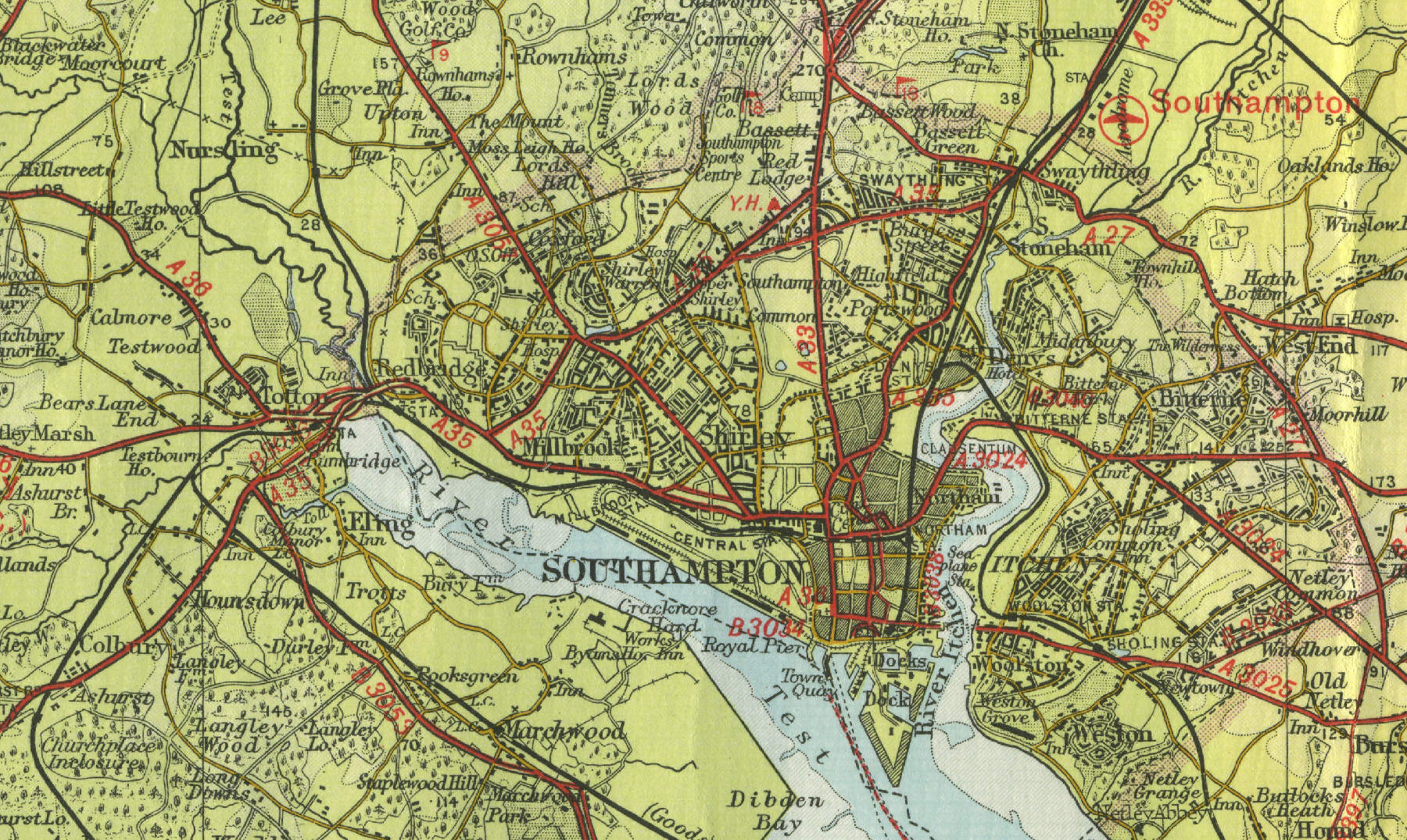
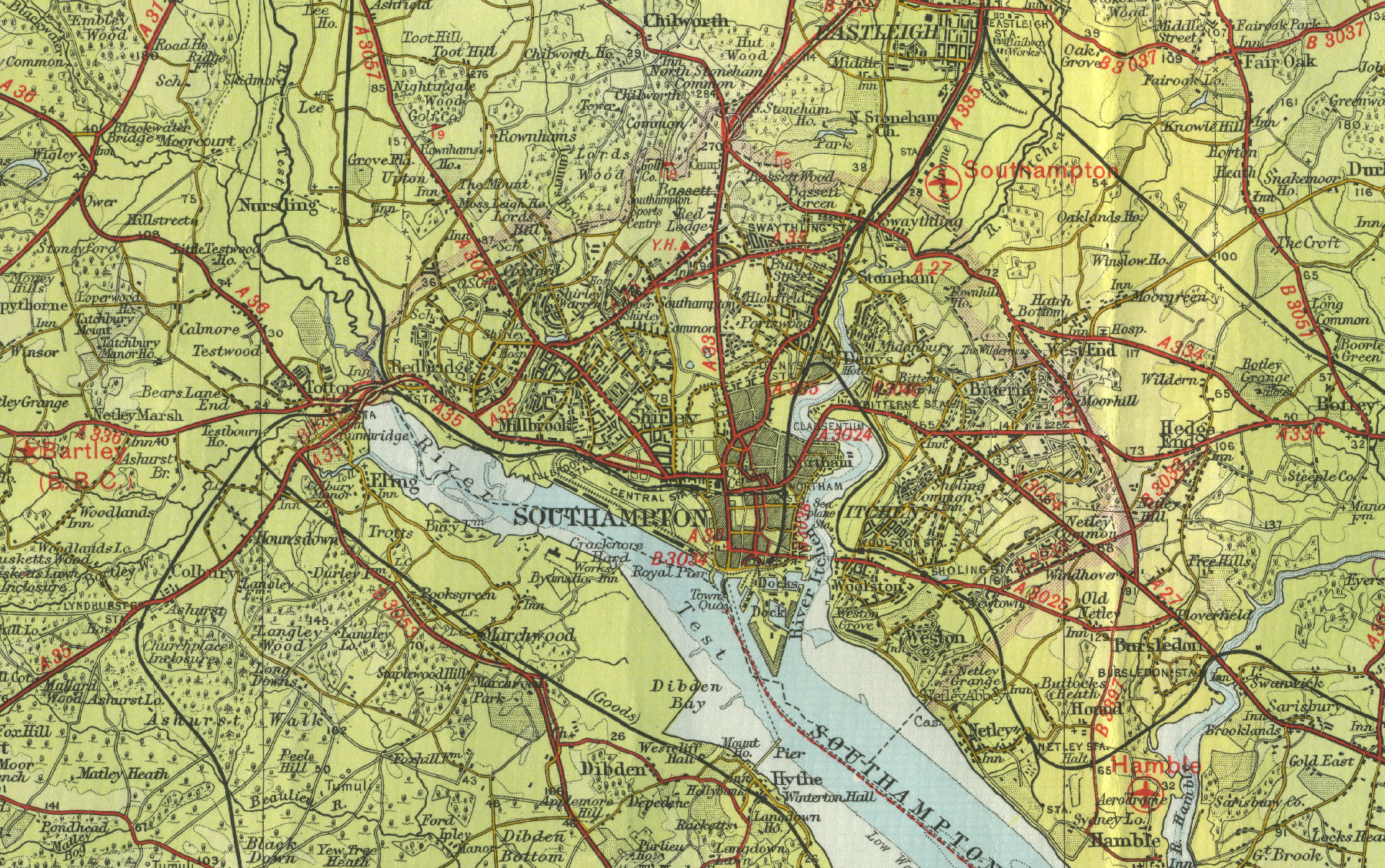
map below shows the city as it was in the mid twentieth century. Click
on a selected area of the map below to see an enlargement.
|