Plymouth
Plymouth, Devon, population around
250,000, is situated at the head of Plymouth sound, at the mouths of the
rivers Plym and Tamar. Once an important Royal Navy base, now rebuilt
and incorporated into the city of Plymouth in the form of Devonport
dockyard, the city is rich in maritime history. It was from Plymouth
that the Mayflower set sail carrying the Pilgrims to the New World in
1620, while Sir Francis Drake is said to have finished his game of bowls
on Plymouth Hoe as the Spanish Armada approached. Other famous sailors
to have sailed from Plymouth include Raleigh, Cook and Sir Francis
Chichester.
Interesting locations include the old harbour area, the Barbican and the
Royal Citadel. Traditionally, Plymouth's economy was linked to its
coastal location, fishing and naval operations in particular. In recent
times it has diversified into the service sector, though boat building
remains important. Tourism also contributes substantially to the
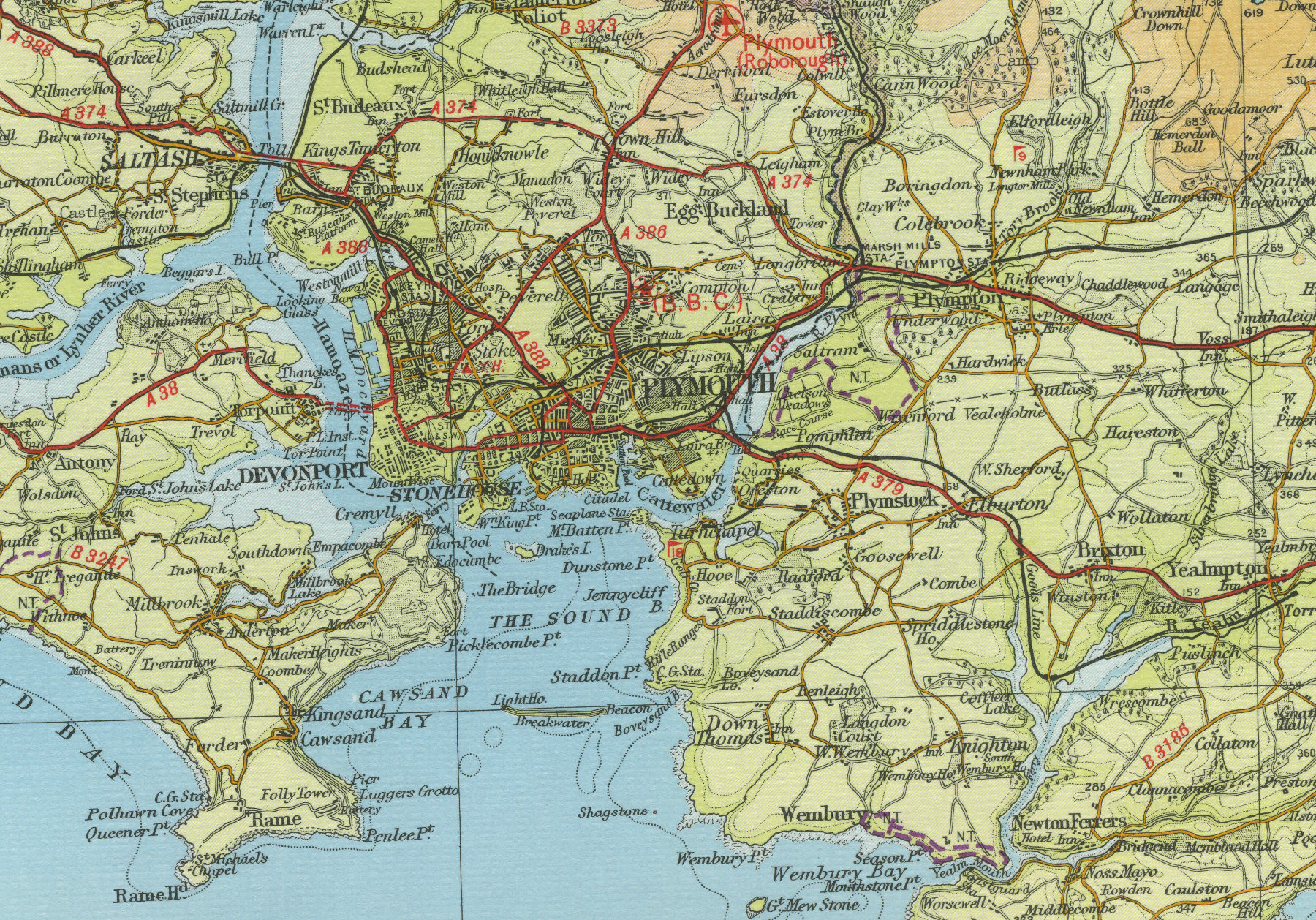
economy. The map below shows the
features of the city, its streets and houses as they were in the mid
twentieth century. Click on a selected area of the map to see an
enlargement.
|