Haddington
Haddington is
situated in East Lothian, about twenty miles east of Edinburgh.
Haddington, at one time, was the fourth largest city in Scotland,
although the population now stands at only 9000. Located on the River
Tyne, the town was at the centre of the Scottish Agricultural Revolution
in the eighteenth century. It is a town of wide streets, notable for its
Town House, built by William Adam in 1748. Haddington was the scene of one of the
longest town sieges in history, when, in the sixteenth century,
occupying English forces were besieged by the Scots and their French
Allies for eighteen months. Important buildings include the Haddington
Town House, The Corn Exchange and the County courthouse.
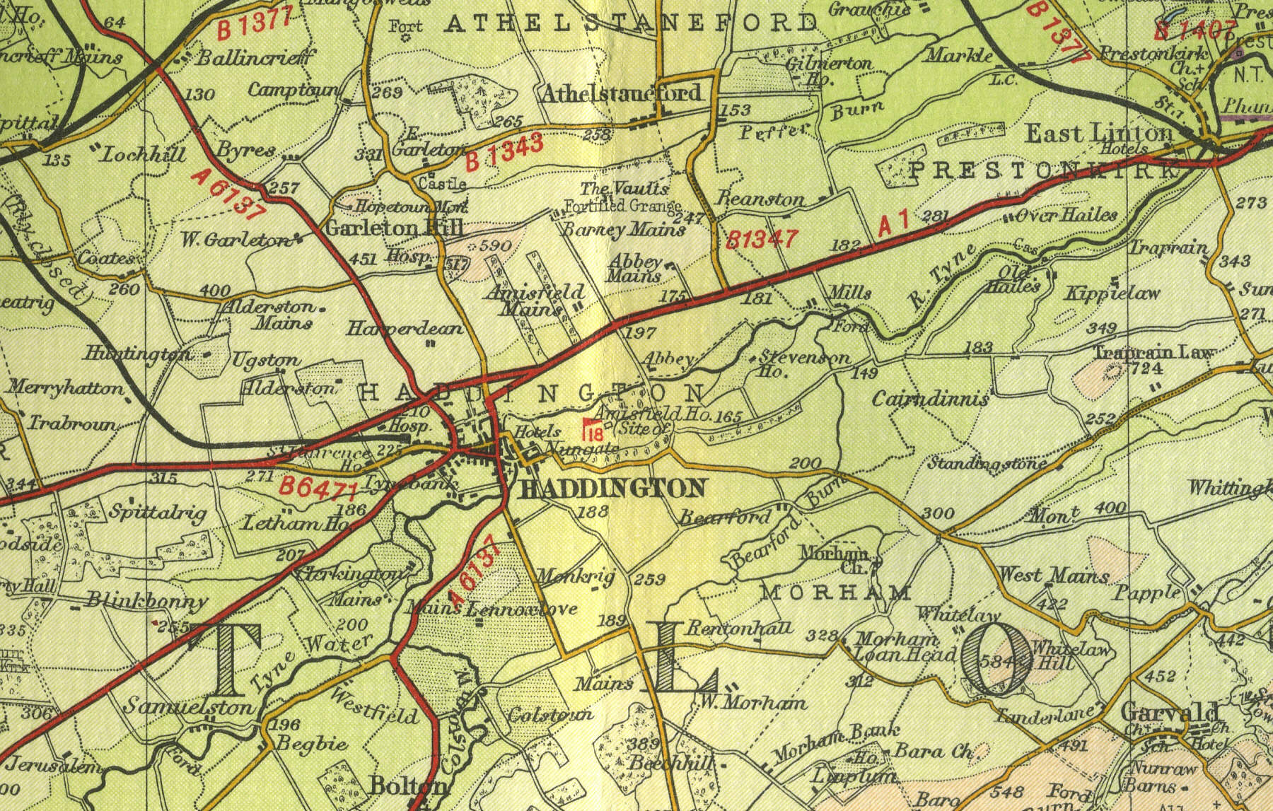
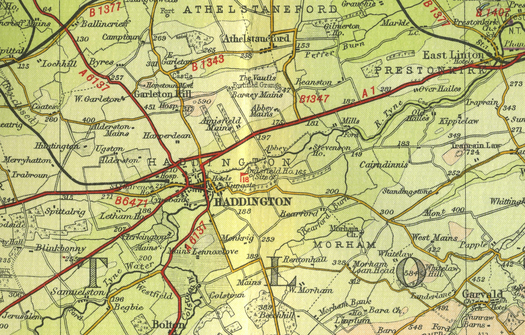
The map below shows the
features of the town as it was in the middle
of last century. Click on a selected area of the map to see an
enlargement.
|