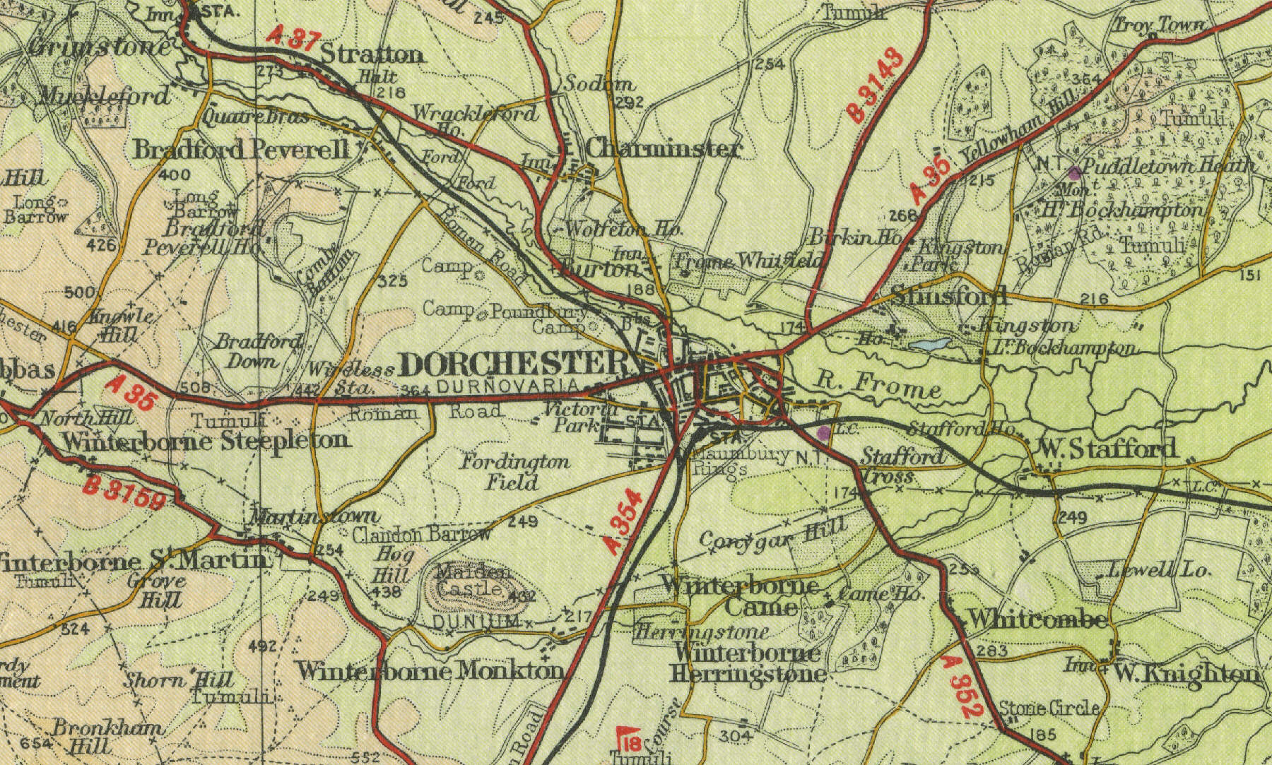
Dorchester
Situated on the river Frome, twenty
miles west of Poole, Dorchester, the bustling county town of Dorset, is an important
market town and shopping centre, with a population of around 16,000 and serving a wide area. The town
dates back to Roman times and its roads follow the route of the early Roman roads. Dorset County Museum has a good collection of Roman
artefacts. In addition, Dorchester is connected to London and
Southampton by the South Western main railway line and to Bristol via the Wessex line. Dorchester
incorporates the village of Poundbury, built
to the west on the site of the old Roman camp on Duchy of Cornwall land.
The town was also home to Thomas Hardy, who based
the fictional town of Casterbridge on Dorchester.
Maumbury Rings, to the south of the town, is the site of a Stone Age
circle and Roman amphitheatre.
The map below shows the features of the town, its streets and houses as
they were in the mid twentieth century. Click on a selected area of the
map to see an enlargement.
|