|
|
|
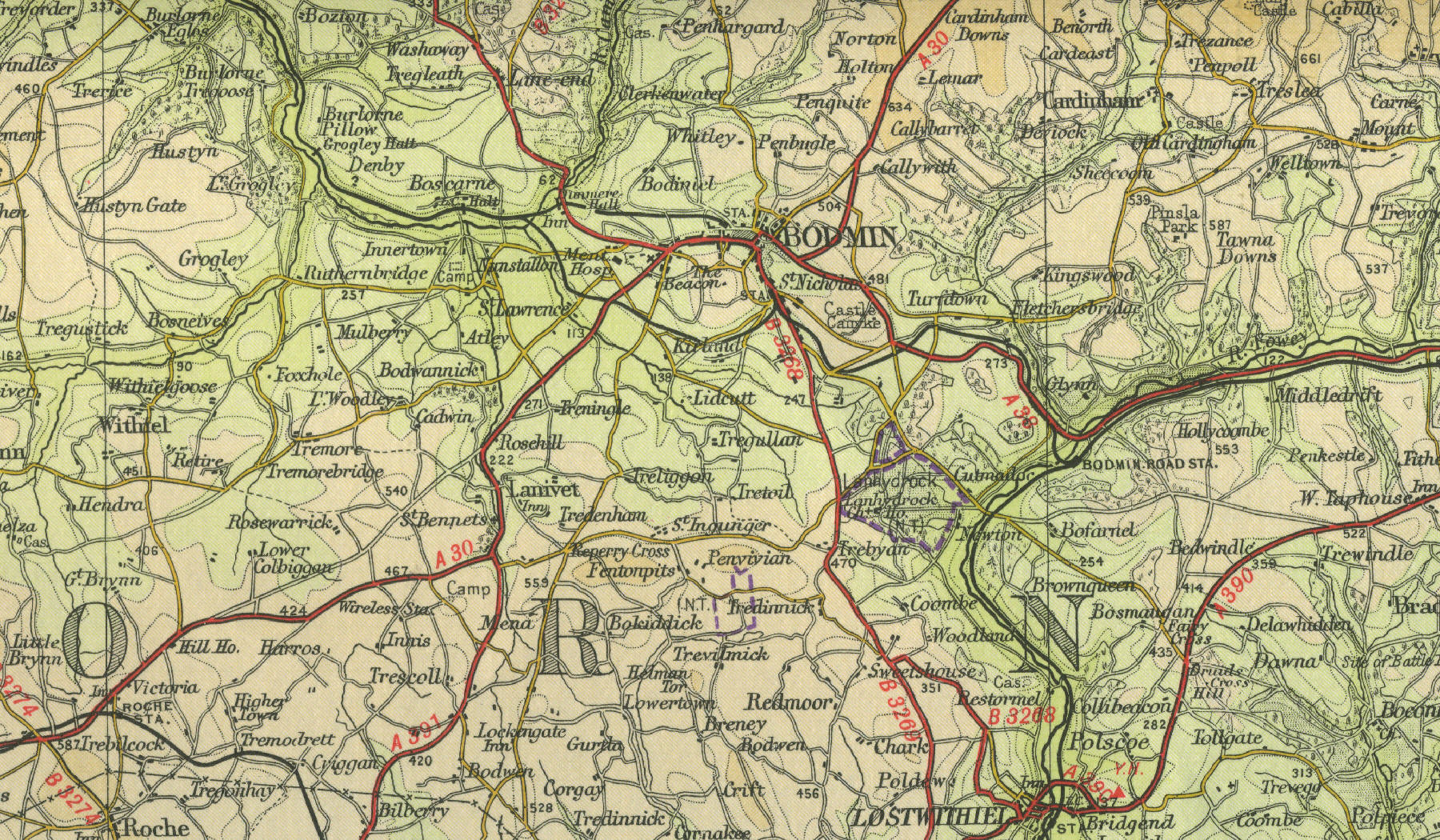
Bodmin
Formerly the county town of
Cornwall, with a population in excess of 15,000, Bodmin lies at the
heart of Cornwall on the western edge of Bodmin Moor. Bodmin is one of
the oldest towns in Cornwall and one of the few recorded in the 11th
century Domesday
Book. Its fifteenth century Norman
church of St Petroc remains one of the largest churches in Cornwall.
Historically, the tin industry was the main employer. At one time the
town was well known for its holy wells, reputed to cure eye complaints. Places of interest
include Bodmin Gaol, site of Britain's last public hanging in the early
nineteenth century.
Other buildings of interest to visitors include the Shire Hall and the
Regimental Barracks, once home to the Duke of Cornwall's Light Infantry,
now a military museum. The map on the left shows the town as it was in the mid twentieth century. Click on
any area of the map to enlarge. |
